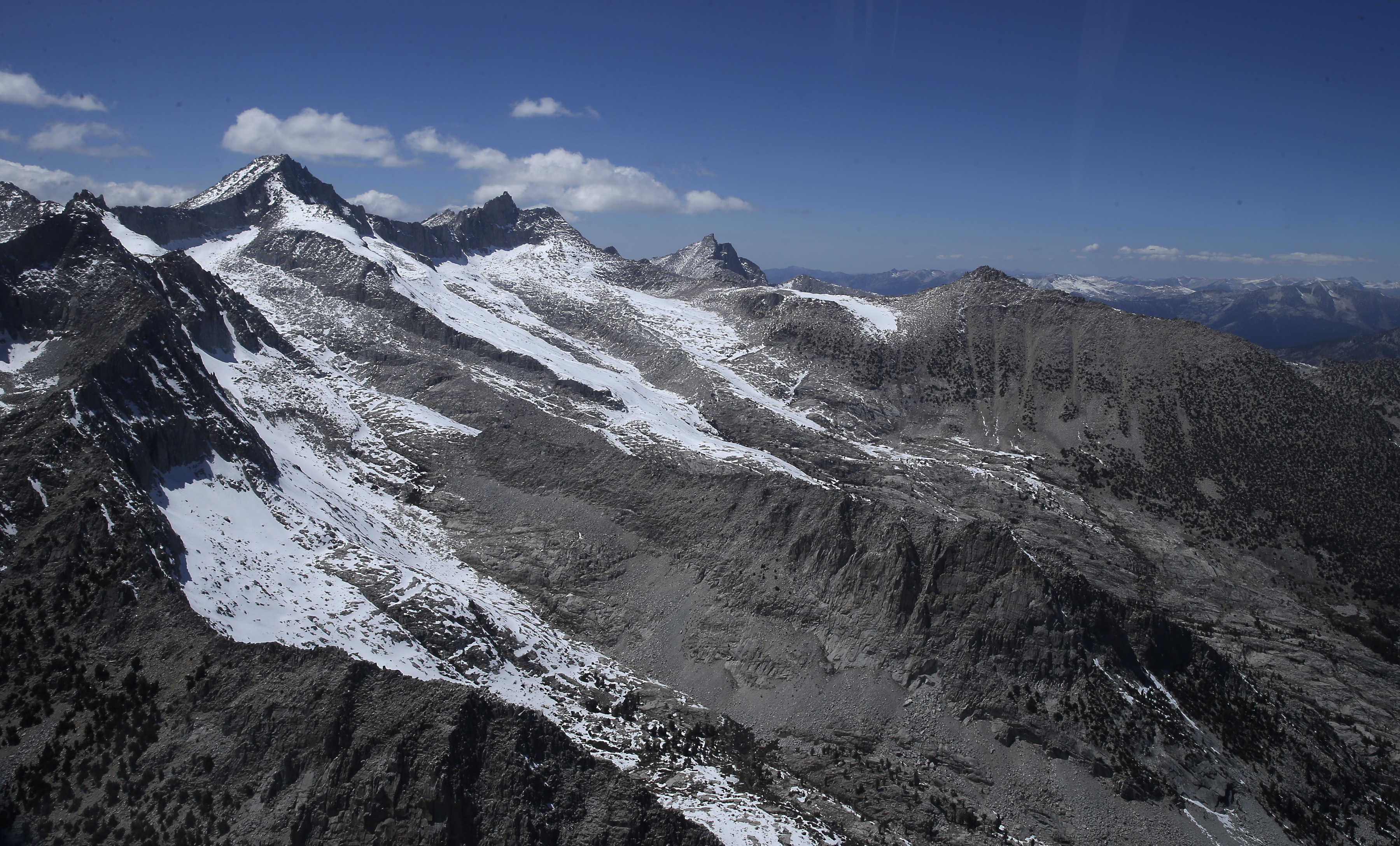
California could see rare August snow this weekend, as a Pacific storm that is unusually strong and cold for this time of year hits the West Coast. There’s a chance of accumulating snow in the high Sierra above 8,000 feet — including the higher terrain in Yosemite National Park — an area that hasn’t seen August snow in at least 20 years, according to the National Weather Service in Hanford, Calif.
“While these are relatively low snowfall numbers, any chance for snow in August is quite rare and has the potential to increase impacts for travelers and hikers Friday night [and] Saturday,” the Weather Service wrote.
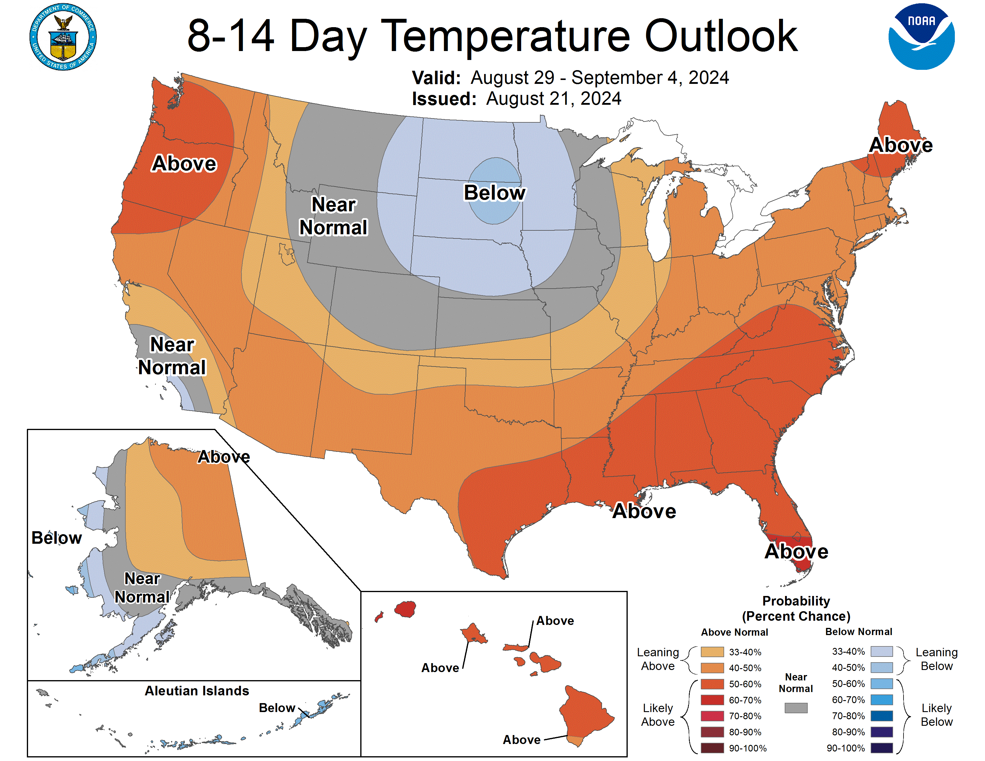
A stagnant, wavy upper air pattern known as an “omega block” is keeping stifling heat in the south-central United States and unseasonably cool weather in the west and east as the jet stream dips to the south along both coasts this week.
As the storm affects the area from Thursday through Saturday, 1 to 3 inches of rain is forecast for western Washington and Oregon, and up to 2 inches of rain in far Northern California, with the northwest corner of the state expected to see the bulk of the precipitation.
The storm’s potential effect on the western fire season
Heavy rain from thunderstorms could cause flooding or debris flows in and near areas recently burned by wildfires.
A flash-flood watch has been posted for the Park Fire burn scar in Northern California for Friday into Saturday, and nearby residents should prepare for potential flooding, the Weather Service said. The fire — the fourth-largest on record in California — destroyed more than 600 structures and is now 429,460 acres and 61 percent contained.
Cooler weather over the past two weeks, along with influxes of moisture, have dampened fire season in parts of the West, and significant rain will further calm the fire risk for some areas.
“We’ve certainly seen fire activity greatly reduced from what we saw toward the beginning of August,” said Jon Bonk, a fire weather meteorologist for the Northwest Interagency Coordination Center in Portland, Ore.
The incoming system, however, will also bring strong winds that will increase fire risk for areas that see little rain. The southern half of California and much of Nevada will stay mostly dry during this storm, and eastern Oregon could see dry lightning that could spark new fires.
“We have concerns that any of those new lightning starts will get fanned by the wind and grow rather quickly,” Bonk said.
Red-flag warnings for high fire danger are up for eastern Oregon, northeastern California, Nevada and Idaho, where vegetation remains quite flammable.
Heat quickly returns
California saw its hottest July on record, as did Las Vegas, and the interior West has endured record-breaking stretches of punishing heat this summer.
While August has seen a reprieve from extreme heat along the West Coast, a quick return to hot and dry conditions is expected early next week.
Fire season in the Pacific Northwest typically lasts until the end of September, and parts of California could see high fire risk into November this year.
“We are by no means expressing that the end of fire season is here,” Bonk said. “We have lots of time still for high pressure to build and for hot, dry conditions to return.”


