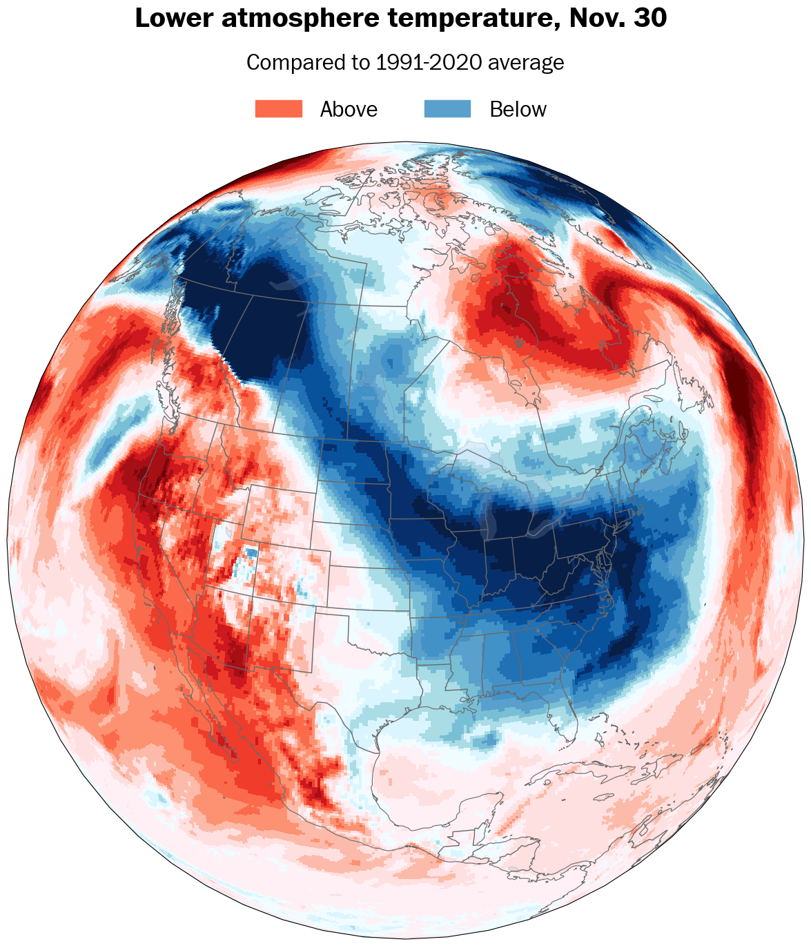
A brutally cold air mass from Siberia meets the record-warm Great Lakes. That’s a recipe for meteorological fireworks.
A lake-effect snow event, which started in the upper Great Lakes early Thursday and will start in the lower Great Lakes on Thursday night, has the potential to be quite spectacular, producing prolific snowfall accumulation and lasting into early next week.
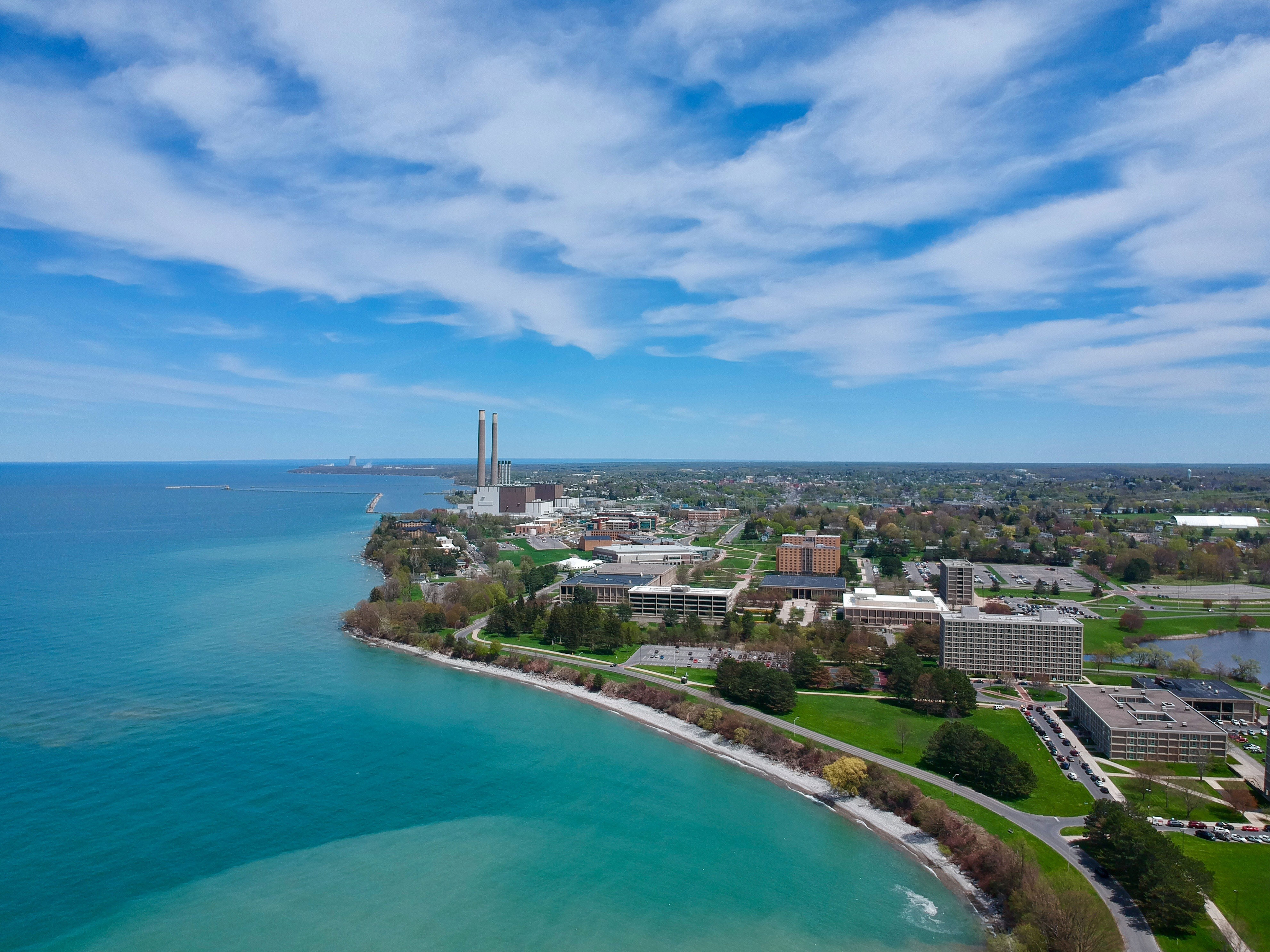
As a meteorologist who learned about the nuances of lake-effect snow along the shores of Lake Ontario — Mother Nature’s laboratory — these are the events we students often yearned for. We packed into cars and drove up to the Tug Hill Plateau, New York, where annual snowfall averages more than 200 inches.
Once you got there, you weren’t really leaving until the event ended. A foot or more of snow sometimes piled up in a matter of hours, occasionally accompanied by thunder and lightning if the conditions were just right, along with whiteout conditions as winds whipped across the near-frictionless surface of the lake.
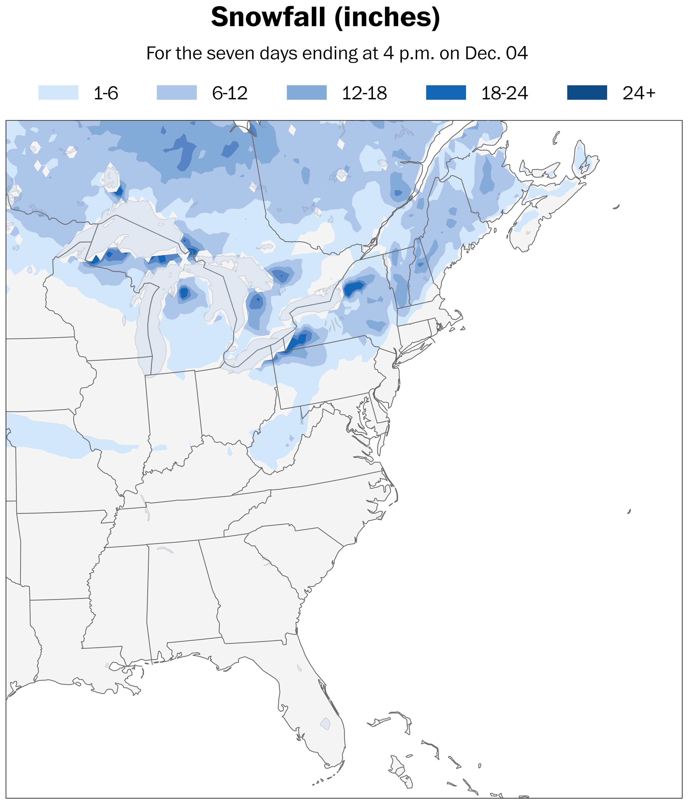
For the event over the next week, the map below highlights the snow hot spots, with more than two feet possible in the most persistent snow bands.
The ingredients that produce lake-effect snow
In the synoptic meteorology classroom at the State University of New York at Oswego, predicting a good lake-effect snow event is far more than just looking at a computer screen.
What’s the temperature difference between the lake and the air mass about one mile above ground? Will there be enough moisture? What’s the wind direction, down to the degree? Will there be a multi-lake snow band connection? Are the lakes iced over? Is there a chance for thundersnow?
These are just some of the questions buzzing around the room of forecasters as a potential lake-effect snow event nears.
Let’s break these ingredients down:
1. Cold air blowing over warmer water
- Why it’s essential: Cold air passing over relatively warm lake water creates instability. The warm water heats the air near the ground, causing it to rise. This rising air condenses the moisture from the lake into clouds, leading to the development of narrow, localized snow bands that are sometimes only miles wide, extending around 50 miles inland.
- Optimal temperature difference: A temperature difference of at least 23 degrees Fahrenheit between the lake and the air about a mile above the ground enhances the instability.
- Extreme temperature difference: Current water temperatures at the Great Lakes are at record warm levels, ranging from about 45 degrees to 54 degrees Fahrenheit. The air mass traveling overhead will range from around 5 to 15 degrees. That equates to a temperature difference of 30 to 50 degrees, leading to even more atmospheric instability, and the potential for thundersnow and snowfall accumulation of 2 to 4 inches per hour.
2. Ample moisture
- Why it’s essential: As cold air moves over the lake, it picks up moisture through evaporation. The longer this distance, otherwise known as fetch, the more moisture it can gather. That leads to heavier snowfall.
- Key factor: Larger lakes with longer fetches, like Erie and Ontario, tend to produce more intense lake-effect snow.
3. Optimal wind direction
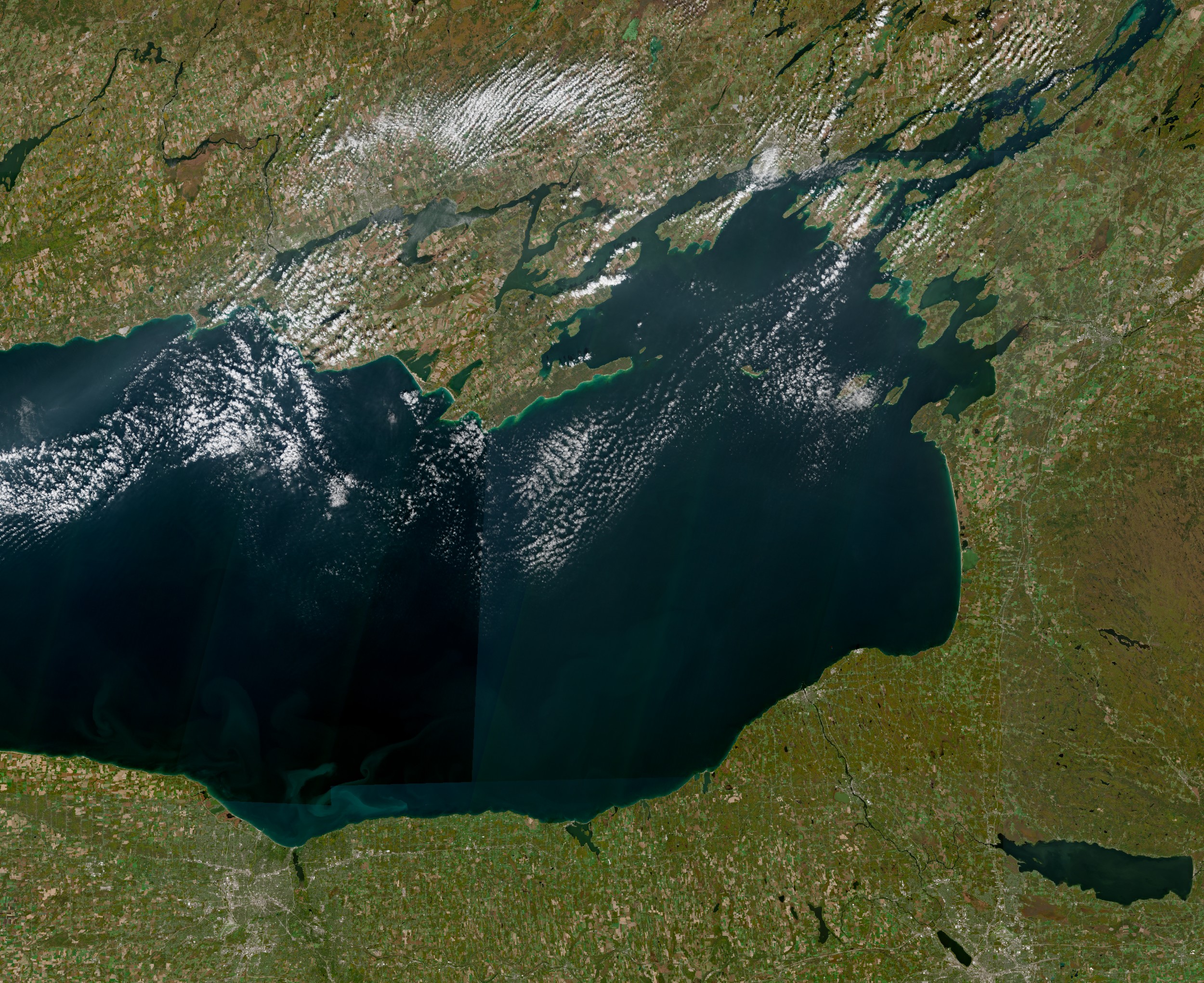
- Why it’s essential: The wind must align with the orientation of the lake to maximize the fetch. Consistent winds blow moisture-laden air toward the downwind shore of the lake, where the snow falls. For Lake Ontario, a westerly wind creates the right conditions, while a southwesterly wind does the same for Erie. If the wind blows just right, a lake-effect snow band from Lake Huron’s Georgian Bay, about 100 miles to the northwest, can join forces with one over Ontario, leading to more moisture and snow.
- Key factor: Winds that blow parallel to the lake’s long axis are most conducive to heavy snow, as they maximize the fetch and therefore the moisture uptake. Uniform winds can focus a heavy snow band over a particular location, leading to extreme snow accumulation.
Bonus factors:
- Topography: Hills or elevated terrain near the downwind shore of the lake — such as across the Tug Hill Plateau — can enhance snowfall through what’s called orographic lifting. Because the air is forced to rise when it hits the higher terrain, the clouds can grow taller and can produce heavier snowfall rates.
- Ice cover: Less ice on the lake allows more evaporation and therefore heavier snow. Ice cover usually isn’t an issue early in the season, but it can be later on.
Where the heaviest snow will fall
The main show was forecast to get underway by early Friday, with snow bands forming and intensifying near Lake Erie and Ontario. Relatively uniform winds were predicted to last through the weekend, which could lock the snow bands in position.
The areas that could be hardest hit include Watertown, New York; the Tug Hill Plateau; and the stretch of Interstate 90 between Erie, Pennsylvania, and Buffalo. Interstate 81 north of Syracuse, New York, could also receive significant amounts of snow.
Scott Steiger, professor of meteorology at the State University of New York at Oswego and a lake-effect snow researcher, said intense lake-effect thundersnow is likely Friday night through Monday east of Lake Ontario. Wind turbines over the Tug Hill Plateau could serve as a focal point for lightning, given their height and the tendency for lightning to strike the tallest target.
As of early Wednesday, the National Weather Service in Buffalo had issued a winter storm watch for areas near Lake Erie and Ontario, citing the potential for a significant, long duration lake-effect snow event as well as road closures. By early Thursday, the watches had been upgraded to a lake-effect snow warning with 2 to 4 feet of accumulation possible from Friday through Monday.
“The potential exists for a significant long duration lake effect snow event. There is uncertainty in exact band placement and amounts, but multiple periods of heavy snow are possible,” wrote the National Weather Service Office in Buffalo.
The office warned that travel in some areas — especially in the post-Thanksgiving period — could be “very difficult to impossible with very poor visibility and deep snow cover on roads.”
Farther west, the snow was also expected to continue into early next week. In Michigan, areas from Kalamazoo to Grand Rapids and Traverse City and then northward toward Sault Ste. Marie and Houghton were among the places expecting heavy snow. Barrie and Owen Sound in Ontario were also in the storm’s crosshairs.
Although the forecast becomes less certain with time, the snow bands have the potential to continue into the week of Monday, Dec. 2, potentially becoming reinvigorated by another surge of Arctic air next Wednesday.
Reliable computer modeling is suggesting the potential for 4 to 6 feet of snow in the hardest-hit areas by late next week.
What this says about the future
As the planet continues to warm, an interesting paradox may develop as it pertains to lake-effect snow.
Because the driving mechanism is cold air riding over the top of a relatively warm body of water, conditions for lake-effect snow, including intense events, may become more likely — at least for a time.
According to the National Oceanic and Atmospheric Administration, “The amount or severity of lake effect snow across the Great Lakes is tied to how ice-free and warm the lakes are as well as the difference in temperature between the lake and the air blowing over it.”
In a warmer world, NOAA adds, “not only will lake temperatures increase, but the lakes will remain ice-free for longer periods of time.”
That may mean more lake-effect snows, even as temperatures increase, “as counter-intuitive as that may sound,” NOAA writes.
It would seem as if this paradox will be in full effect over the next week as the weather pattern remained conducive to lake-effect snow.
